
Map: Track Map LG
Map: Track Map LG
Couldn't load pickup availability
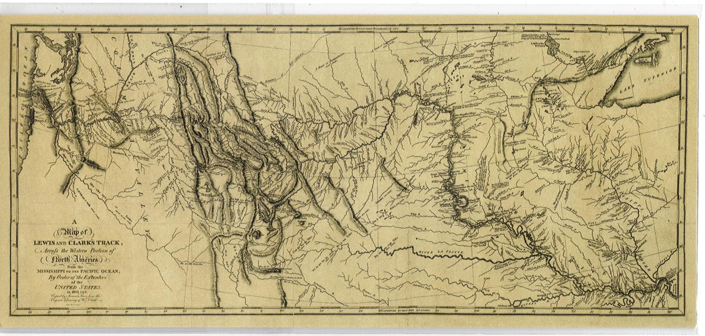
Clark's Track Map, 34x18.
Full Title: A Map of Lewis and Clark's Track, Across the Western Portion of North America From the Mississippi to the Pacific Ocean; By Order of the Executive of the United States, in 1804, 5 & 6. Copied by Samuel Lewis from the Original Drawing of Wm. Clark. Smal. Harrison fct.
Author: Lewis, Meriwether ; Clark, William ; Biddle, Nicholas ; Allen, Paul
Date: 1814
This map and the written account of the expedition changed American mapping of the northwest by giving the first accurate depiction of the relationship of the sources of the Missouri, the sources of the Columbia, and the Rocky Mountains. The map was copied by Samuel Lewis from William Clark's original drawing, and was engraved by Samuel Harrison. The map appeared in Lewis and Clark's History Of The Expedition Under The Command Of Captains Lewis And Clark.